NavSource Online: Army Ship Photo Archive

Please report any broken links or trouble you might come across to the Webmaster. Please take a moment to let us know so that we can correct any problems and make your visit as enjoyable and as informative as possible.

| Click On Image For Full Size Image | Size | Image Description | Source | |
|---|---|---|---|---|

302618702 |
102k | Cape Fear - is a prominent headland jutting into the Atlantic Ocean from Bald Head Island on the coast of North Carolina in the southeastern United States. It is largely formed of barrier beaches and the silty outwash of the Cape Fear River as it drains the southeast coast of North Carolina through an estuary south of Wilmington. Cape Fear is formed by the intersection of two sweeping arcs of shifting, low-lying beach, the result of longshore currents which also form the treacherous, shifting Frying Pan Shoals, part of the Graveyard of the Atlantic. (Wikipedia) Photo - NASA satellite photo, showing the estuary of the Cape Fear River Map - showing the Cape Fear River drainage basin. Kmusser, CC BY-SA 3.0, via Wikimedia Commons |
Tommy Trampp | |

302618701 |
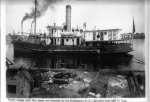
70k | USED Dredge Cape Fear moored, date and location unknown.
US Army Corps of Engineers Philadelphia District |
John Spivey | |
| Back To The Navsource Photo Archives Main Page | Back To The US Army Ship Index | Back To The US Army Dredge Index |
| Comments, Suggestions, E-mail Webmaster. |
|
This page is created and maintained by Gary P. Priolo |