 |
36k |
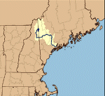
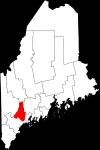
Namesake: Androscoggin - A river formed on the Maine-New Hampshire border by the confluence of the Magalloway River and a short outlet of Umbagog Lake. The stream flows generally south for some 35 miles through New Hampshire, then turns eastward, enters Maine a few miles west of Gilead, and meanders along a generally southeasterly course until joining the Kennebec below Bowdoinham in an estuary of the Atlantic called Merrymetting Bay. A county in Maine also carries the name Androscoggin which in turn is derived from the name of an Indian tribe which lived on the banks of the river. The word Androscoggin is an Indian term meaning "fishing place for alewives" or "spear fishing." |
Tommy Trampp
Photos added 25 October 2021 |
 |
153k |
14 May 1920
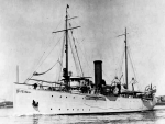
USCGC Androscoggin at dock at Boston Navy Yard, MA. The wooden planking of the hull can clearly be seen
Photo by Crosby Naval Photgrapher, 11 Portland St., Boston, MA
Naval History and Heritage Command photo S-553-K |
Tommy Trampp
Photo added 25 October 2021 |


